Tag: travel

  • Georgia Was First Settled by Criminals!

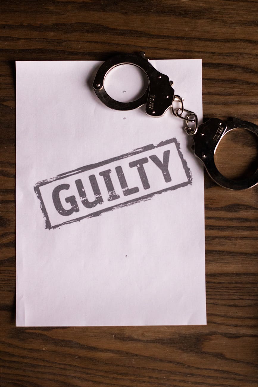
    Did you know that the state of Georgia was first settled by criminals?

    The settlement of Georgia began with James Oglethorpe; a British soldier whose mission was to help the prisoners who were being treated poorly by the British prison system.

    Photo by KATRIN BOLOVTSOVA on Pexels.com

    Oglethorpe was a Parliament member and a humanitarian. He worked tirelessly to help the prisoners especially those who were imprisoned on minor charges for instance like imprisonment of unpaid dept and with his position in the British Parliament, it gave him the access to men to fund a debtor’s colony in the New World and after three years King George II approved it which would become the 13th colony of Georgia.

    However, Oglethorpe’s mission was put on hold when the King George stipulated that the colony must make money and return it back to the crown. Oglethorpe then gathered 114 men, women and children and set sail for the new colony of Georgia.

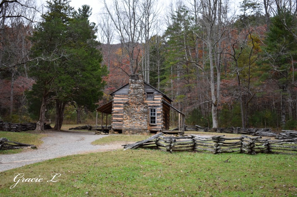
    The first of Oglethorpe’s ships landed in Georgia in 1732 and by February of 1733, Oglethorpe had friended the local natives and negotiated a land plot near Savannah Georgia to settle.

    Back in Britian before sailing for the new land, the colonists were gifted with cotton seeds which became the main crop of the colony of Georgia and still is one of the main crops of the state of Georgia today.

    After arriving in the new colony, Britain then sent over 60,000 men, women and children who were considered ex-convicts but only a few were sent to Georgia. The rest were sent to Maryland and Virginia to settle.

    Although Oglethorpe never reached his goal of making Georgia a dept free colony, but he did want to be certain that everyone who settled in the colony had an equal chance of becoming a prosperous citizen.

    Although, Oglethorpe never succeeded on making Georgia a place where the colonists could do for themselves, colonize and learn to trade, he did succeed on founding the colony now the state of Georgia.

  • One Of Georgia’s First State Parks Is in North Georgia!

    Did you know one of the first two Georgia state parks to ever be established is right here in North Georgia?

    Vogel State Park located in the North Georgia mountains not far from Smithgall State Park, Amicalola State Park and Unicoi State Park is one of the first two parks that Georgia ever established in 1931.

    During the early twentieth century cars were becoming extremely popular and so was tourism that’s when Georgia took knowledge of the new movement by joining the national movement to establish state parks in 1927. They also wanted to preserve the Indian Springs Reserve in Butts County, Georgia and the state senate called for resolution.

    The resolution resulted in Indian Springs and ten acres of land around it to be placed under the jurisdiction of the State Board of Forestry with the idea of turning the spring and the land around it into a state park.

    After this proposal in 1931, the Georgia State Parks was established, and the state created a commission that established Indian Springs as a state park as well as Vogel.

    During the next six years five more state parks would be added to this list including Santo Domingo (now Boys Estate) near Hofwyl -Broadfield Plantation, Alexander H. Stephens, Chehaw (which is currently a local park) and Pine Mountain which is now F.D. Roosevelt State Park.

    Vogel was established as a forest park with the reorganization of the State Board of Forestry. The reorganization act created a commission to administer the Department of Forestry and Geological Development.

    Vogel is nestled in the Chattahoochee National Forest at the base of Blood Mountain in Blairsville, Georgia which is the highest part of the Appalachian Trail in Georgia. The park is located at 2500 feet above sea level and is linked to several generations of Native Americans living here before the Europeans arrived and rightfully so with its breathtaking beauty!

    The park today is 233 acres not including its 22 acre lake. Visitors have the option of staying over 34 cottages, 90 tent, trailer and RV sites, 18 walk-in campsites and 1 pioneer campground.

    Visitors also have the option of reserving 4 picnic shelters, 1 group shelter which seats 90 and 1 lake pavilion which seats 100.

    Today visitors can enjoy this park’s natural beauty by hiking over 17 miles of trail including hiking to Trahlyta Falls, fishing, swimming and kayaking.

    The park also has a general store and a seasonal CCC Camp Museum.

    After the establishment of Vogel and Indian Springs State Park, in 1937 the state reorganized the organization again splitting it into several divisions including the Division of Forestry, Division of Wildlife, Division of Mines, Mining and Geology and then finally the Division of State Parks, Historic Sites and Monuments.

    Today’s state park system is the direct ancestor of this park.

  • How Ducks Avoid Frostbite in Cold Waters

    Have you ever seen a Wild Pintail or Mallard Duck swimming and riding a river current and wondered just how do they swim in freezing cold and not get frostbite in their bare feet like us humans do? Let’s find out!

    Too much of the cold blood would bring their body temperature down which would then lead to hypothermia but ducks have another way of solving this!

    Ducks feet are not insulated through layers of fat nor feathers so with this being said, they instead rely on another source of warmth called “countercurrent”.

    As warm arterial blood rushes out of the duck’s heart and begins traveling its way to the duck’s feet, it is met closely by the rushing cold blood coming out of the duck’s feet. In birds the veins and arteries run close together therefore as they pass each other, the cold blood from the duck’s feet takes most of the heat from the artery causing the artery blood to be extremely cool before entering the duck’s leg, preventing any heat loose from the Duck’s body.

  • Georgia’s Wild Turkey Population Is in Serious Decline

    Here in the Appalachians where I am from turkeys are becoming less and less seen. I used to see and photograph dozens of turkeys around here each year but sadly I have not photographed the first turkey this year. This put me into research mode, and this is what I found out!

    According to the Georgia Department of Natural Resource, state agencies and researchers across the state of Georgia and the Southeast have been monitoring and watching closely turkey reproduction and the turkey harvest season each year and sadly they have seen alarming declines in the populations of wild turkeys.

    The poult or “baby turkey” hatching and growing rate is a fraction of what it was two decades ago. The poult count per each mother hen average has been on the decline since the late 1990’s. The poult count per each hen is around 1/3 of what it was at its peak. The average poult count is currently around 1.5 to 1.6 per hen.

    So what is causing these severe declines in the population?

    Coyotes and other predators are a major fact to this disruption of the poult or baby turkeys as they are nothing but a treat to them. A majority of nests and broods of poults are ravaged each year.

    Habitat changes like short timber rotations, hardwood removal and suburban development has caused these birds to lose their habitats or homes making it more difficult for these guys to reproduce and thrive.

    Last but not least is illegal hunting activity. Research has shown that gobbling, which is necessary for a male to win over a female during breeding season is being disrupted by hunters who are illegally taking male turkeys “toms” in their most vunerable times.

    By removing “toms” especially dominant toms, hunters could be impacting breeding activities and therefore disrupting the turkey population.

    The Wildlife Resources Division is currently working hard to help conserve and save the population from further decline.

  • Natural Remedy for Bee and Wasp Stings

    Honeybees, Bumblebees and other insects are working tirelessly working to pollinate each and every flower bloom but while this is occurring, accidental stinging accidents are happening as well!

    Bee’s normally sting when they feel threatened or if their home is felt to be in great danger.

    So why does the sting of a bee hurt so bad? Bees have multiple chemical variations including acidic in their venom that they inject through their sting and for some people, the sting will be mild but to those that are allergic to these variations of chemicals, it can be deadly.

    Honeybee’s will normally only sting though if their hive is felt threatened. Worker bees are the only ones beside the queen that can sting. Male honeybees (drones) cannot sting. When a honeybee stings, it’s stinger has a barb and if the victim has thick skin the barb will sometimes get stuck in the victim.

    So how can you help the swelling and the pain from the sting?

    Apple cider vinegar is a great way to break down the venom, prevent infection from the sting and to reduce the swelling of the sight. Take a brown paper bag and soak diluted apple cider vinegar into the paper bag and wrap it around the sting if possible. This should help the sting affected area but if it doesn’t and causes irritation or a reaction stop immediately.

    Also, from someone that has a moderate reaction to bee stings and swells really badly, I recommend taking an antihistamine immediately after the sting happens.

  • Tennessee Is Named from This Underwater Town!

    Hidden underneath the Tellico River in Vonore, Tennessee lies the Cherokee Nation’s first capital city of Tanasi.

    The capital was in effect from 1721 to 1730, 46 years before the Declaration of Independence was signed.

    Tanasi attained political prominence in 1721 when its civil chief was elected the first “Emperor of the Cherokee Nation”. About the same time that this had occurred, the town name was also applied to the river on which it was located.

    During the mid-18th century, Tanasi became overshadowed and absorbed by the town of Chota which was located to the immediate north.

    So how did Tennessee get named from the town of Tanasi?

    The first recorded spelling of Tennessee as it is today occurred on Lt. Henry Timberlake’s map of 1762. In 1796, the name Tennessee was selected among several as most appropriate for the nation’s 16th state.

    The flooding to create the Tellico River in this area caused the town to become underwater. The flooding was caused for the Tellico Reservoir and to complete the construction of the dam on the Little Tennessee River.

    The site of the former town of Tanasi is now underwater and is located about 300 yards west of the Tanasi marker.

    Folks from all around can come to the Tanasi Memorial on the Tellico River to pay tribute to this underwater but never forgotten town!

    If ya’ll are interested in visiting here is the address to the marker

    Follow Hwy 360 to the junction of Hwy 360/Hwy 455 for about 5miles. Then turn left onto Country Road 461 where you will then turn right to the Tanasi Memorial.

  • Bear Safety Tips!

    Black bears, a fierce creature but yet gentle until provoked! So how do we keep these beautiful creatures and our family safe without harming you or the bear while camping? Here are a few ways!

    1. Do Not Feed The Bear!

    Sure, Black bears look cute and cuddly from a distance but don’t let that get to you! Bears are extremely territorial especially with food as it is their natural instincts to compete with other animals for food in the wild.

    2. Leave the bear be!

    Bears are not meant for up-close and personal encounters as this might result in your last encounter! If you find yourself accidently too close, stop, back away from the bear and do not turn your eyes away on the bear as these are wild animals and are extremely unpredictable! If the bear still follows you, make loud noise and make yourself larger than the bear by raising your arms above your head!

    3. Bring Bear Spray!

    This is a last result option but if the bear begins to attack you, spray the bear and the bear more than likely will leave. It’s completely safe for the bear and only requires discomfort for a few minutes.

    4. Lock Your Food Inside Your Car or Camper!

    Food locked away is a bear’s best friend as a fed bear is truly a dead bear! Bears continue to come back to the campground of which they were fed and when you don’t feed the bear, the bear becomes severely angered and can result in an attack!

    5. Don’t Camp in Any Campsite with Leftover Food Left in It!

    It always a good rule of thumb as you don’t necessarily have to be the one who left the food behind but those before who did probably attracted in some kind of wildlife with it which would include bears! So, always be alert when pulling into a new campsite with some leftovers as it might come with a furry guest as well!

    I hope these tips were helpful! Happy Camping Everyone!

  • Georgia’s Only County Named After a Woman!

    Nestled deep in the North Georgia mountains on the South Caroline and Georgia state line, just northeast of Athens and just South of Toccoa lies a very interesting county. I’m talking about Hart County.

    Image by National Geographic

    Hart County is named after a woman by the name of Nancy Hart. Nancy Ann Morgan was born around 1747 and is a Revolutionary War hero. The neighboring native Americans had great respect for Nancy and even referred to her as “War Woman” or “Wahatchee” in Cherokee.

    She married a man by the name of Benjamin Hart and together in 1771, they obtained a 400-acre land grant 25 miles southeast of Hartwell and they built a log cabin home.

    Legend states that Nancy served as a spy for General Elijah Clarke and occasionally even disguised herself as a man. The most famous story about Nancy occurred during the Revolutionary War when 7 British soldiers arrived at her cabin near Wahatchie Creek. Her normal hostility toward the British was replaced that day by a cordial manner and she even offered the soldiers a meal. Meanwhile, while she was doing this, she sent her daughter to the spring for water and she sent her with a conch shell to blow which would signal a summoning for help.

    The British soldiers began to drink, while Nancy kept a good eye on them and their muskets that were carelessly stacked in the corner.

    Nancy managed to sneak two of the muskets into a space in the wall but by the time she got to the other muskets she had been caught by the British. One of the British soldiers ran after her but she was an expert marksman and dropped him to the floor another British soldier followed and she shot and injured him. The rest of the soldiers remained from provoking Nancy. Maybe it was the fact the she was 6 feet tall and red headed or maybe it was the fact that she was armed and they weren’t. Either way Nancy kept them contained while she waited on her husband and his friends to arrive.

    Although this was said to be a legend, after a work crew building the railroad unearthened the truth, it is safe to say that this was not in fact a legend but in fact the truth!

    Nancy worked tirelessly on helping her newborn country doing so many things, from tying logs up with grapevines to be able to cross the Savannah River to collect the badly needed information to even dressing up as a man and protending that she was crazy just to get into the British Camp and to collect vital information on the British troop movements.

    Nancy was even related to Daniel Boone and Colonel John Dooley

    The natives even named the creek that ran by her home “Wahatchee” after Nancy which is now apart of the Georgia State Park Nancy Hart State Park and the replica cabin can be seen today and the original stones from the chimney of the original were used in the remaking of the cabin as well.

    The representation of Nancy Hart may be seen on the Hart County Seal. The seal was designed by Robert W. Knowles and was adopted as the official seal on May 8, 1990.

  • The Road into Cade Cove is Not the Original Road!

    With millions of folks around the nation and world for that matter coming to visit The Great Smoky Mountains National Park each year, it’s safe to say that the roads are used to their maximum now days, but did you know that the road into Cades Cove is not the original route that the settlers used?

    Back when Cades Cove was a thriving local family community, settlers used five different roads (which we will get to in a moment) to exit and enter the Cove. None of which is the road that we all take to enter the Cove by Little River from Townsend, Tennessee and Gatlinburg, Tennessee.

    The settlers mostly used these five roads to commute back and forth to gather food, supplies and other needs in town. The roads include Rich Mountain Road which can still be drove on by visitors today but just in select seasons of the year though! It is located on right side of the loop straight across from The Missionary Baptist Church. This road was used most commonly by those who lived in the center of the Cove. Rich Mountain takes you through the heart of the Smokies into the mountains which we all call home and takes you to Tuckaleechee Cove just on the outskirts of Townsend. It is graveled and pretty tough terrain so I would recommend a high off the ground vehicle.

    Another common road that was used was Crib Gap Road. This road is not a drivable road but nevertheless still a true part of Cades Cove’s history. This road took the settlers east to the Anderson Turnpike which then went to Tuckaleechee Cove just like Rich Mountain Road. This road is now a 3.9 mile out and back trail and is considered moderately challenging.

    Cooper Road was another used road by the settlers. It was used as a direct route to Maryville straight from the Cove. Cooper Road is now a 11.1 mile out and back hiking trail that can be accessed at the upper end of Abrams Creek Campground. This is considered a moderately challenging trail.

    Rabbit Creek Road was located at the Abrams Creek Parking Area and headed back south to Happy Valley which is located just to the east of the Foothills Parkway West Overlook #14 and just west of the Abrams Creek Campground.

    Last but certainly not least is Parsons Branch Road which is located just a few miles from the Cades Cove Welcome Center and about 1/4 mile from Henry Whitehead’s Cabin. This road is accessible by car but is graveled and pretty rough terrain so I would recommend a high off the ground vehicle. This road allowed settlers to access to Parsons Turnpike in the south and now days provides visitors access to U.S. Route 129 or what is most commonly known as “The Dragon”.

  • Is There an Underground City Below Cades Cove?

    Alot of rumors have been passed from generation to generation as to where and if there is an underground city below Cades Cove.

    On Monday, March 27th, 2017, the National Park Service performed maintenance on the John Oliver Cabin. The cabin was one of the first cabins to ever have been built inside of the cove.

    A crew member by the name of Brian Crimmins was cleaning the cabin’s fireplace when suddenly the floorboards where he standing began to buckle under his weight.

    While giving an interview with the local media outlets, Crimmins explained what he just happened.

    “I’m a pretty big guy, so I don’t think the old wood floors were accustomed to supporting someone with my build. When I knelt down to start cleaning the fireplace, I started to hear a cracking sound, and before I knew it, I had fallen through the boards. I was pretty embarrassed at the time, but now I’m really happy that it happened.”

    After Crimmins was safely removed from below the floor, crew members were shocked to find a tunnel under the broken boards. This discovery prompted the National Park Service to bring in the help of Dr. Dennis Poliferno, a noted archaeologist and historian from the University of Tennessee. Under Dr. Poliferno’s direction, a series of expeditions were made in the tunnel from March 28th to March 31st.

    Some believe that the mile long tunnel beneath the cabin leads to a large underground city that was inhabited by the Cherokee tribe.

    Now this story sounds very convincing. There’s only one issue this news which was first published by experiencecadescove.com and the story is indeed just an April 1st joke.

    No one ever has reported nor discovered an underground city if there is one, but I bet a lot of you now are like me and are really wondering if there is an underground city and if so, where is the city’s location?

    For now, it is just a joke but who knows what the future holds! There’s always new Cades Cove history discovered!